


The lower Red River
By Wesley Houp
June. The early morning rain tapers off. My eggs, sunny-side-up, are runnier than I normally like. But I don’t complain, masking the mucussy whites beneath a hard triangle of buttered toast. It all goes down to a good spot. Danny lords over his sausage melt and home fries (“covered and smothered”), glancing furtively out pane-glass at neutered clouds. Dad, our shuttle-master, sips his coffee and polishes off the last bite of biscuit from his modest breakfast set. Wafflehouse on the Winchester Road exit of I-75 is abuzz with grizzled truckers, rough couples trapped in leather with inexplicably demonic tattoos—in from a Friday night of god-knows-what, and harried moms with their wild-eyed, towheaded children suckling up more syrup than hotcake. People on the go, people on the edge, people on the run, all people on the fringe of town…and us: just more wide-eyed people on the fringe of what comes next. But this morning we’re aiming to plush that fringe with the green distance of the Mountain Parkway. We’re Red River-bound. So we sop up yolk and thank the waitress while Dad pays the tab, a treat he erroneously predicts as our last “hot one” for a few days. At 72, with his river-ratting days mostly behind him, he’s forgivably unfamiliar with our new-fangled, compact, culinary technologies. To echo Lexington crooner Chris Sullivan, we can make a three-course meal from a worn out shoe.
The car-jammed lot pulses with diesel fume. We police our canoes and gear, trundled this far with insufficient rope yet still secured, layered, hull-side up in the bed of dad’s primer-gray GMC. In minutes we’re rolling down Winchester Road, and a half-hour later we’re on the Mountain Parkway. To our north, the community of Indian Fields (or “Indian Old Fields”) in Clark County marks the spot where, in 1752, a young Irish-born Indian trader (huckster?) named John Findley swapped goods with the natives at the village of “Eskippaki-thiki,” located along a small creek near the old Warrior’s path, the much-used north-south thoroughfare running from the mouth of the Scioto on the Ohio River (near present-day Portsmouth, OH), through the famous gap in the Cumberlands, to Cherokee settlements in Georgia. Three years later, 1755, Findley would hawk his visions of Eden to a kind-natured but restless young woodsman born of the Quaker state and tempered on the Carolina frontier. These fireside divulgences fanned the flame of wanderlust and set Daniel Boone’s course for the future: unflinchingly headfirst, farther into the wild, western interior.
A few miles more down the Parkway, we cross over an unassuming tributary of the Red River where Boone, Findley, John Stewart, James Mooney, Joseph Holder, and William Cooley made camp on June 7, 1770, 242 years ago—to the day. As Boone would later write, “On the seventh day of June following, we found ourselves on Red-River, where John Finley had formerly been trading with the Indians, and, from the top of an eminence, saw with pleasure the beautiful level of Kentucke.” That night, Boone entertained the men with a rousing, laughter-filled reading of a personal favorite, Jonathan Swift’s Gulliver’s Travels: “Saith that in the year 1770 I encamped on the Red River with five other men and we had with us for our amusement the History of Samuel Gulever’s Travels where In he gave an account of his young Mistress Glomdelclerk carrying him on market day for a show to a town called Lulbegrud.” According to R. E. Banta’s history of the Ohio, this little volume “must have been highly prized indeed, since its owner was willing to allow it space in his pack which might otherwise have accommodated an equal bulk of powder to stand between him and starvation in the wilderness.” Today, the creek of their enlightened encampment goes by “Lulbegrud,” only a slight corruption of Swift’s “Lorbrugrud.”
We exit south on Route 82 at Powell Valley; a mile or so down the two-lane highway we cross over the Red. After scouting the south-side of the river, we turn back and reluctantly decide to put in on the northeastern end of the 82 bridge. It’s a downhill carry, 100 yards or so, through kudzu and poison ivy, but we manage in three trips to move our boats and gear to water’s edge where Dad snaps a parting photograph, the two paddlers sweaty and grinning, just before we dip in beneath the bridge’s massive concrete pier. The water’s rising, swirling greenish-brown but trending toward a milky chocolate, and while it might be 10am topside, both hands of our clock reset to zero, the first second of day one on river-time.
The lower Red

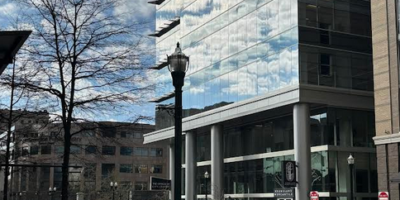
Lower Red River. Photo by Wes Houp.
The lower section of the Red, according to paddling guru Bob Sehlinger, is incomparable to the upper and middle sections, which flow through the Red River Gorge, a National Natural Landmark with Wild and Scenic River designation. The Gorge, with the help of environmental groups like the Sierra Club and Kentucky’s most renowned writer and activist, Wendell Berry, survived several concerted attempts at impoundment. When President Clinton signed the National Wild and Scenic River declaration into law in 1993, he ended a decades-long struggle to protect and preserve this geological and biological wonder.
In his 1978 guide to Kentucky’s waterways, Sehlinger warns that the lower Red is “almost always clogged with deadfalls that force portaging or swinging continually back and forth across the river to navigate around them.” In addition, it courses through private property, unsuitable for camping. Undeterred, we float quickly past the open pasture on the south side and enter a green wall, the river’s channel forming a small tunnel, like the adit of some overgrown, abandoned mineshaft on an overgrown and abandoned mountainside.
We encounter several significant deadfalls but manage to find passage without much technical maneuvering, and after a half mile the channel widens, and the banks steepen to 45°, sloping up 50 feet or so to intermittent limestone bluffs, the entire riverscape blanketed in the tender green light of young maples. The current pushes us along, and our paddle-strokes are light, more for righting our canoes than increasing forward momentum. In no time we pass Plum Branch, where the Red River becomes the boundary between Powell County to the north and Estill County to the south, and within an hour we steer by the mouth of Mill Seat Creek.
The Red plains out, due west for a short stretch, and softly bends southwest, taking in the waters of Lulbegrud which enters from the northwest at a 45° angle and forms a rocky point at its confluence. We stop for a cold beer and to ponder the likelihood of Boone and Co. standing on this bar 242 years earlier. Our pondering involves more silence and surveillance of the surroundings than oral deliberation on the topic. After twenty or thirty minutes of idleness, Danny stands, brushes the sand and pebbles from his shorts, and gesticulates with his Bitburger pounder. “This place is rife with ghosts. You never know. Boone might have clanged the noontime grog-bell on this very spot and summonsed his wilderness-weary, woolly, calloused, and stinking comrades to frontier fellowship.” I raise my head from the book I’ve rummaged from a dry bag, John Graves’ Goodbye to a River, and counter: “Some days load themselves with questions whose answers have died, and maybe never mattered hugely.”
Grog-bells aside, the place shimmers with ghost-potential. Just upstream at Eskippaki-thiki, Findley had been welcomed into the thriving and surprisingly cosmopolitan town, what Banta calls an “open city” as its inhabitants were a mix of Cherokees, Shawnees, Delawares, and Miamis, among other tribes. He erected his own “shop” amid the many permanent structures already in place, and for the next year lived among and did business with the natives, passing travelers, and fellow traders attracted to the relative peace and prosperity that seemed to shelter the community. But this charmed, sylvan and, as Banta calls it, “complacent” episode came to an abrupt and violent end when, in 1753, the renegade Dutchman Phillip Phillips set upon the town with a band of French-attached Indians from the north, and burned Eskippaki-thiki to the ground, killing and disbanding the natives, and capturing a passel of colonial traders. Findley escaped to settlements in the southeast, having witnessed the life and death of perhaps the last permanent Indian town in Kentucky.
After a quick dunk, we’re back in the boats. Not too far down the river, though, Danny turns with serious expression. “You know what Graves had to say about places like this: ‘Sometimes you take the country for itself, for what shows merely, and sometimes it forces its ghosts too upon you, the smell of people who have lived and died there. They do not have to be individual ghosts…often they’re only the feel that a time past has for you, the odor of an era… And they don’t have to smell good.’” We pick up the silence where we left it, content that Graves should have the last word.
Leapfrog
The cool, shadowy Red is pleasant reprieve from the heat and from our usual paddling milieu on the broad Kentucky, where the dearth of shade forces one to hug bank for narrow relief, navigating the continuous gauntlet of sunken deadfall and stumps, ducking under spidery limbs, and tangling paddle-strokes in the muddy mess of the riverside. Plus, the Red, at least on this trip, provides current, current provides leisure, leisure provides, well, everything that hard paddling doesn’t. A mile or so downstream from Lulbegrud, the Red circles back on itself, an open bow bending back to the northeast, and just when it reaches due easterly course the channel cuts back to the northwest for a few hundred yards, turns sharply west by southwest, and holds a steady course for several miles.
Paddling in pairs is like a game of leapfrog: without stakes, without much regulation, and without a real sporting rationale—at least for Danny and I. We have no pecking order, no strong leader, no deferential follower. We tend to leapfrog one another in pace: Danny at once stopping to scrawl something in his shirt-pocket-sized notebook while I pass downstream only to stop near a deadfall or shoal, cast a spinner-bait or sling a worm and cork into shallow water. Shortly, Danny passes by with a nod and disappears around the bend. I might overtake him an hour or a mile later where he’s stopped for a swim or just to poke his head bankside to take in unfamiliar terrain.
Small pleasures
The river jerks north at a right angle, and the community of Vianna hides somewhere beyond the northern shore. Traveling by river, particularly in the Kentucky River watershed, where the Kentucky’s deep abrasion has forced its will upon tributaries, we are plucked from the plenum of existence. The world is the river, the coterminous stretch of sky, bounded on each side by terminal banks. Occasionally, sounds from beyond filter down to us, but for the most part this narrow world carries us along its surface, and things unseen beyond the edges are there only because experience or memory says they are there, or, as in our current situation, because the map says they are there. So we nod in the direction of Vianna as the river pushes us northward.
We round a sharp bend, the current constricting and gaining speed, and the river double-backs, due south for a few hundred yards. Just around the next bend, we hear falling water; our spirits rise. The majority of our river-womps have involved placid, flat water. The rapids, riffles and shoals of the Kentucky have been submerged for well over a century, drowned out by the Corps’ Promethean if not Pyrrhic victory of impoundment. But in the words of Luna Leopold, Aldo’s river-minded son: “There is no theory of river action and behavior to guide river ‘improvement.’ We in the United States have acquiesced to the destruction and degradation of our rivers, in part because we have insufficient knowledge of the characteristics of rivers and the effects of our actions that alter their form and process.” Depending on the time of year, the watershed provides few opportunities for whitewater, and they’re scattered widely and most often more suited for cramped kayaks, not open, spacious canoes.

CSX Railroad. Photo by Wes Houp.
The river nearly doubles its width in the sharp bend, the water flattening and backing up to cover the broad shoal of a small, unnamed spring creek entering to the south just as the river turns north again. Fifty yards beyond a solid ledge angles halfway across the current, constricting the flow into a narrow chute, the only passage, bordered by another broken ledge on the other side and a rapid clogged with large, water-smoothed stones. It’s only a class II rapid, but we line up with excitement, shoot through, trying our best to catch the roughest waves like thrill-junkies experiencing profound withdrawal. “I could take another mile or two of that,” Danny exclaims over the rush of water, turning his canoe and eddying back toward the run. I let the increased current spin me around into the eddy and cast a spinner-bait into the riffles. No sooner does my lure hit the water than a bass strikes, leaps in the air, and dives down, swirling and driving out into the current, fighting hard to counteract the shrinking distance between us and the arc of my rod. A largemouth, just keeper-sized. I thumb him up to eye-level as Danny takes notice. “Dinner?” As we turn and pull away the yellow stringer trails like a leash, and the bass follows along against every once of instinct.
The Iron Age
In less than a mile, we round a sharp, shoehorned bend and immediately spin back to the south. The CSX railroad crosses the river at a bias, its impossibly spindly trestle spanning the valley high overhead, throwing down two equally spindly legs, their stone feet planted squarely in the river’s flow. We float between them, such colossal foundations for such scrawny stanchions, straining to scan the length of tracks zippering the sky above. On our left, a series of three dilapidated brick structures, stacked at 50-foot intervals, stretches up the slope, 200 feet or more. Danny breaks stride and paddles over for a closer look. “What do you think?” I call as he scampers up the bank.

Old ironworks. Photo by Wes Houp.
“Don’t know. Some sort of forge or furnace perhaps? An ironworks? The proximity to the railroad suggests some sort of extractive industry.” Overturned on the slope above, what appear to be two large, rusted boilers lie on their sides, half-buried in the talus of limestone and leaves. I rummage through my small bag, remove my camera, and snap a few quick shots of Danny standing in the gaping window of the second structure.
“I bet this is an old ironworks,” Danny proclaims while dangling out the window to examine the outer wall above. “According to Mary Verhoeff, the first ironworks may have been in operation in Red River country as early as 1793 in the vicinity of Clay City, Powell County, and near the mouth of Harkwick’s Creek.”
We climb to the highest structure, resting for a moment in the shade among proliferation of ant lion dens, and gaze down at our toy-sized boats through a large opening. A remarkably cold flask of Svetka appears from Danny’s pocket. “What? Do you have ice in your pockets?” I ask before two stiff glugs. Behind us, an overgrown roadbed switchbacks up the remaining slope in the direction of the railroad. The lime-dusty floor of the structure and the immediate slope are littered with oddly shaped bits of pig iron, grotesque icons of a disbanded religion and relics of the patron saint of rust. Abandoned industry on such a large scale in such remote geography shadows thought with tragic possibility: Who toiled here in the forgotten forge? And what did their toil earn them? What was the name of the last man to pass up the switchback when work was done, and where did he fall at last into the earth? We pass a pipe and wait for the third-shift to rise from the sleep of the grave.
W. Houp
Hugh, from what I’ve read, Findlay’s story after Boone’s capture is sketchy at best. The only reference I’ve found to his death comes from an article by Lucien Beckner published in the Filson Club’s “The History Quarterly” in April 1927. According to Beckner, in 1772 Findlay transferred his estate (two parcels of land that his wife had owned) to his daughters living in Lancaster, PA and raised stakes for another wilderness trip. He would have been 53 years old at the time. Apparently, Findlay “died soon afterwards, far from his loved ones–perhaps with his boots on.” I can’t verify the accuracy of Beckner’s account. He doesn’t attribute a cause of death, although during his first foray into Kentucky with Boone, he had to be left behind at one point because of sickness. I’d very much like to know his story as well. Thanks for writing.
gerald parker
I’ve read all your river and creek stuff, and have kept copies of the papers. Well, I’m a direct descendant of both John Findley,my seventh-great-grandfather,
and also Ebenezer Hiram Steadman. Both on my mother’s father’s side of the family, but the two guys were not related. Steadman, of course, was generations later.. Are you familiar with the book “Bluegrass Crafstman”, origionally published by U of K press, 1959?
W. Houp
Great, Gerald! Findley is one of my characters from the period! How cool to talk to a descendant. I have not heard of that book, but it sounds really good. I’ll definitely check it out.
Hugh Findlay
I’m very interested in what happened to John Findlay after Boone was captured. All the text that I have read about him has him disappearing from history? It also has his name spelt Findlay. Even today, the name Findlay is mispelt with either an a or e and with out a d on an almost daily basis. John Findley/Findlay’s story was well known by the Findlay’s of Shaw from AyrShire and a relation. Its intriguing. Could anyone tell me his story after he escaped when Boone was captured?