
Last week, I wrote about the $17 million South Limestone road improvement project of 2010, which included pedestrian, bike, utility and sewer upgrades. Completed in time for the city’s hosting of the World Equestrian Games, the South Limestone improvements were lauded as vital infrastructure that successfully fulfilled “town/gown” mandates. Here is then-Vice Mayor Jim Gray providing this ubiquitous Mission Accomplished viewpoint:
The theme from the beginning was to join the university and downtown and create an exciting and compelling environment that would be a seamless experience of engaged urban space from South Limestone, through downtown, past Transylvania, up North Limestone to Loudon, where a thriving young arts community is developing.
Jim Gray, 2010
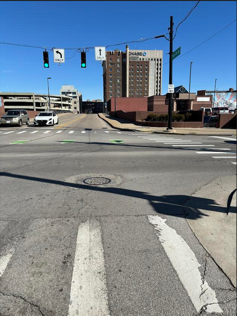
As I noted last week, the South Limestone project failed on two important accounts. First, it rather dangerously suggested that this road was somehow bike-safe:
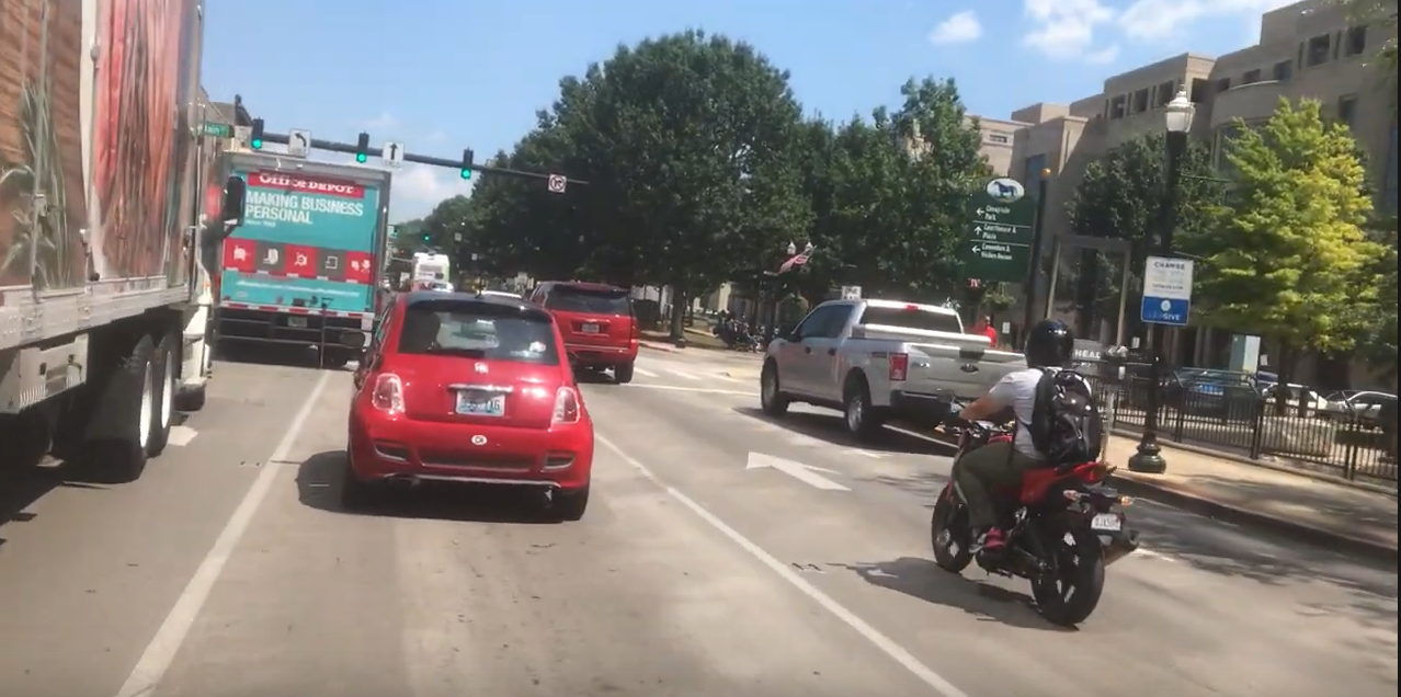
As an early and public example of an expert-certified “complete street” bike lane, this first-order failure of the South Limestone upgrade looms large enough at the infrastructure level. As a city, we were certifying failure, and then building more of it.
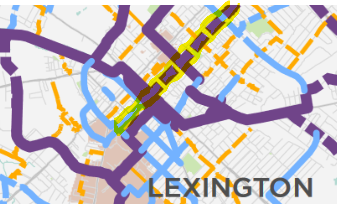
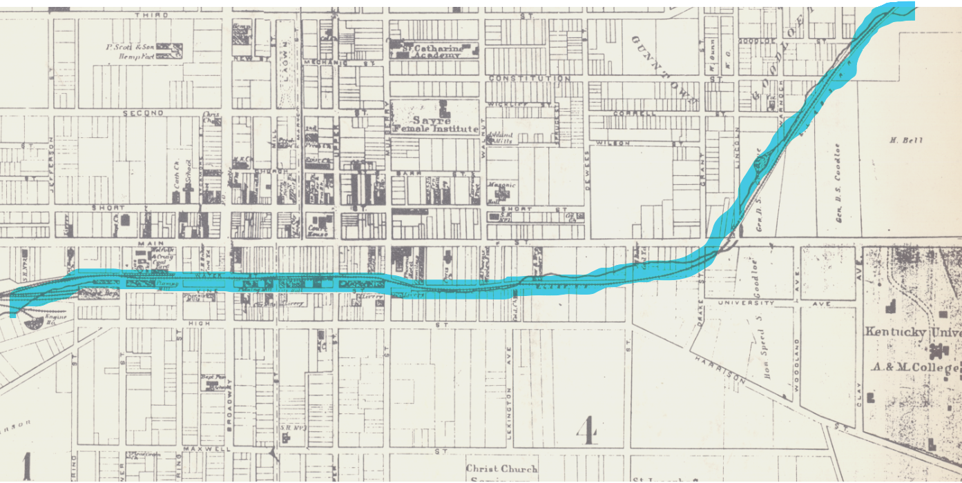
To get a sense of this failure, take a look at the downtown portion of the LFUCG Bike-Ped Master Plan “Recommended Bikeway Network” map, published in 2018. The graphics are poorly done, so it is tough to state for sure. But the South Limestone pictured above is rated by city officials as either a “Major” (purple) or “Minor” (blue) roadway. In other words, a preferred route for bikers moving north through town.
Look close at the map and you’ll see that throughout the city. Most Major and Minor suggested bikeways in Lexington, both completed (solid lines) and forthcoming (hashed lines), are, irl, paint-on-road lanes placed atop major auto thoroughfares. Holy Fayette Urban County that is dangerous!
The first-order infrastructure failure represented by Limestone has also worked against the project’s broader civic and financial goals. It was hoped that the road upgrades would help push the 40,000+ people at the University of Kentucky campus through downtown and into Lexington’s northside neighborhoods, where city leaders hoped this UK population could live, work and play with northside natives and other newly-arrived highly-educated creative transplants.
In reality, though, the lauded Limestone infrastructure still meant that we moved from UK to Al’s Bar or North Lime Donuts in the same ways as before: By car. Up Limestone. Down Upper. This represents a second, broader, failure of the Limestone project. It did nothing to further the city’s stated Town-Gown goals. More of the same was sold to us as something different.
This week, let’s take a look at the connective possibilities of Martin Luther King (MLK) Boulevard, a north-south running street located just one block east of Limestone.
As a bike route, Limestone surely sucks. Could MLK be better?
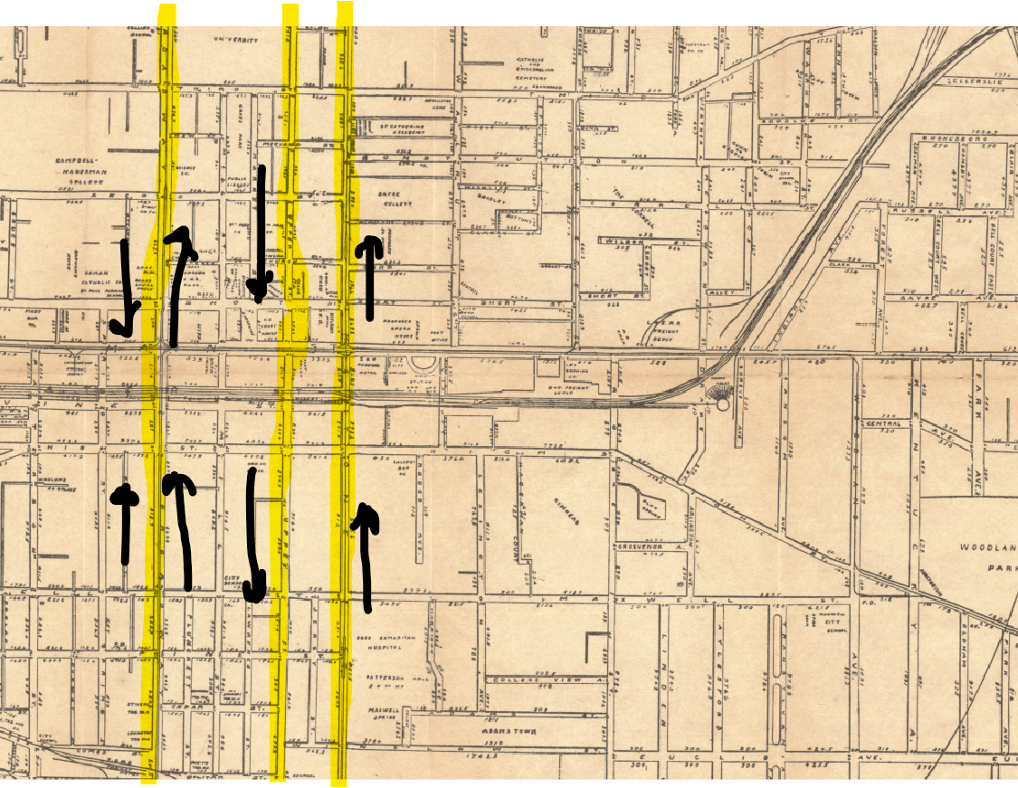
Bikers may not be aware of MLK. The street is not approved for use by our city’s biking experts. Here again is that Recommended Bikeway map produced in 2018. I have bracketed the unmarked Martin Luther King Boulevard with black arrows.
With MLK not considered a Major nor Minor nor Local bikeway, bikers are instead encouraged onto…Limestone and/or Rose.
2018 Recomended Bikeway map, with un-marked MLK Boulevard bracketed by arrows.
I am no expert. Just a dufus with a bike. But owing to Lexington’s recent and also long-ago development history, MLK seems the most suitable route for transiting UK’s student, staff and faculty into and out of north Lexington via bicycle. Because it is the most suitable, MLK also represents the best opportunity to use alternative transportation to better the (supposed) long-standing civic desire for improving longstanding gaps in our Town-Gown relations.
A brief history of creek crossings and north-south movement in Lexington as it pertains to MLK Boulevard
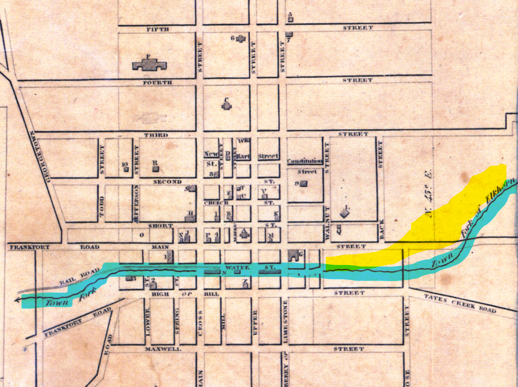
Movement through town has always been impeded by Town Branch creek, which bisects the town just below Main Street. The reason for this is surely known to most any self-respecting Kentucky kid: creek banks can be a pain in the ass to cross.
In the case of Lexington’s Town Branch, the creek’s northern banks provided early residents a relatively gentle elevation gain out of the floodplain. This is where development centered. Modern drivers may be oblivious to this rise, but hikers and bikers surely still feel it on their trek to Arcade Bar or Forage.
Travel south from Main Street, though, and early travelers had to immediately endure a steep ascent of an incised creek bank in order to get to the appropriately named High Street, where things generally leveled out. We might surmise the best creek crossing for footed or mounted passers-through by taking a closer look at the 1818 map shown above, which identifies a “Main Cross Street” of the Town Branch (now known as Broadway).
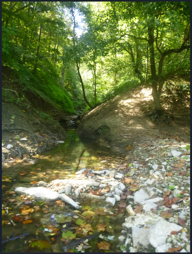
Here’s that creek bank elevation from present day High Street, looking in on Mill Street as it descends into the Town Branch creek bed and then out of it, rising to Main.
This Town Branch geomorphology, while restricting north-south movement, has encouraged movement parallel to Town Branch. Above the creeek, east/west roads Main, Short, Third, Fourth, Fifth, Sixth, Seventh, and later Loudon have been extended over the decades. Attesting to this relative ease of movement, Lexington development has also trended east/west within the limits of the northern Town Branch floodplains.
To the south of the Town Branch, a similar pattern emerges. Development runs east-west along High Street (the Main Street of south Lexington). Later Maxwell Street and Euclid ran parallel to High. Notably, and as an enduring legacy to the timeless childhood knowledge that creekbeds suck for crossing, the area south of Town Branch has developed at an order removed from that of its northern banks.
The conjoined twentieth century rise of the University of Kentucky and car culture has altered but not eradicated Town Branch’s dividing power. Gas powered cars fueled the half-century of southern suburban migration across the Town Branch. From homes built into the rolling hills of South Lexington, an economic pathway was established in which residents passed back and forth over Town Branch on their way to and from work in the various offices and industries of North Lexington. Meanwhile, the growth of UK provided an international job center untethered to the more parochial Main Street commercial interests to the north, cutting out entirely any need to cross the buried creek.
But the Town Branch is still there, many of us must still descend into and then ascend out of it, and our choice of crossings have become crowded over the years. With the partial closing of Rose Street to traffic by UK, north-south auto traffic has become funnelled through a very few Town Branch crossing roads. Auto traffic is now directed onto bi-directional Broadway and the paired 1-way streets Limestone and Upper. Here these modern auto-crossings are highlighted.
current traffic directions.
Apologies for the historical detour. This was done to underscore that ensuring safe and efficient north-south passages across downtown Lexington and Town Branch is a timeless concern with long-term hidden effects on city growth, even in an age where cars somewhat surmount the human work it takes to lift up and away from a creek bed. We may have forgotten the limitations imposed by the Town Branch, but that does not mean that the limitations no longer exist.
MLK: forgotten north-south bike infrastructure
As a population, bike-riders are more akin to our nineteenth century forebearers than modern car-drivers. Physical geography matters. Issues of incline and proximity matter. In placing human-powered bikers on main-thoroughfares for carbon-powered automobiles, our local experts seem to have dismissed these ever-legitimate human concerns.
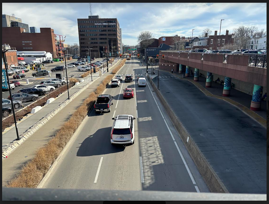
South Limestone is a main auto thoroughfare through Lexington. This matters to the biker forced off the roadway and onto the sidewalk with unsuspecting pedestrians.
One block east of Limestone, Martin Luther King Boulevard provides far superior biking options for north-south movement. To be sure, MLK still has issues. But in comparison to all other downtown possibilities for north-south crossings, MLK provides the most upside. Here are some reasons why.
First, MLK is a beheaded roadway. Because it only runs two miles, from the UK Student Center to Sixth or Seventh Street, the road receives only a fraction of the auto-traffic of Limestone, Upper, Broadway, and even Rose/Elm Tree streets. This beheading makes MLK the least-used north-south roadway for a span of nearly three miles, roughly from Woodland Avenue all the way to Oliver Louis Way.
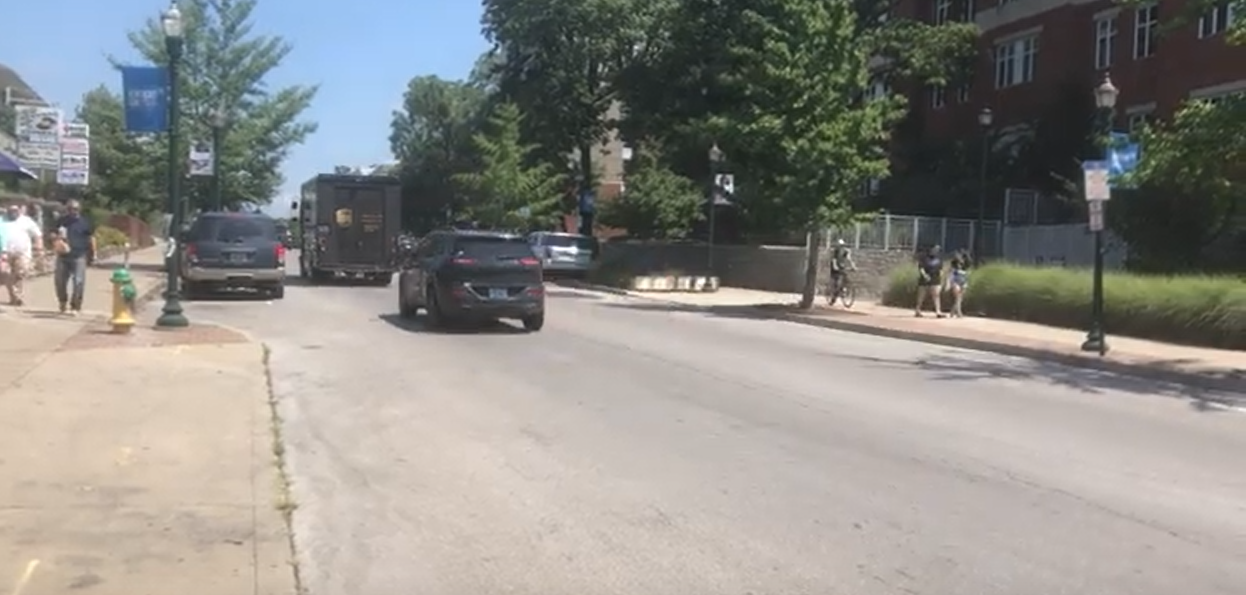
Second, while it has comparatively little auto-traffic, MLK is nevertheless situated amidst the most dense portion of the 40,000+ UK campus population, which places it amidst the most dense parts of the entire city. Here is the road’s southern terminus at the intersection of three different high-rise student dorms and the recently renovated UK Student Center.
Here is a recent video of MLK’s southern terminus. I begin on high-traffic Avenue of Champions (Euclid) and then turn onto MLK. Note the decrease in traffic, something that no biker can expect should they turn onto the expert-approved Limestone road one block away:
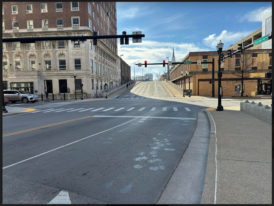
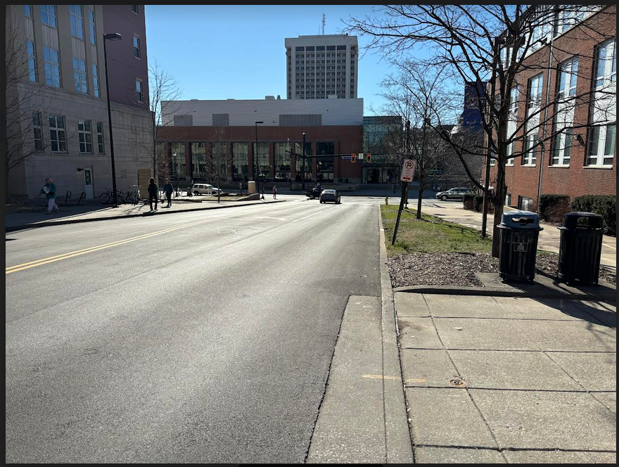
Yet another significant comparative advantage of the MLK bike route is its Viaduct. Built initially to bypass the railroad tracks that ran over top Town Branch, the MLK Viaduct now allows users to bypass downtown’s most highly trafficked street, Vine. This bypass of Vine Street makes MLK unlike any other north-south running downtown street.
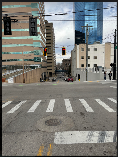
At the same time, the bridge crossing smooths out the human-power requirements for surmounting the Town Branch creek bed. On Broadway, Mill, Upper and Limestone crossings through town, one’s bike-momentum is always at risk of interruption from Vine Street red lights, not to mention fast-moving traffic. Meanwhile, check out how the viaduct smooths out the descent/ascent trajectories of the other north-south roads. (Note also the MLK bonus of providing a truly unique and beautiful view of the Lexington urban landscape):
The northern portions of MLK are also more strategically located than nearby alternate routes. Lexington’s Town-Gown concerns largely centered on better connecting the university to its diverse northside neighborhoods. These concerns were largely governed by the Lexington Brand, which tightly bound development to a few downtown areas, notably Limestone.
A more inclusive transit network, one that also prioritized getting northside residents south across Town Branch, will have somewhat less to do with short-term visits by UK students to northside commercial establishments along Limestone. Here, MLK’s low-traffic route is well-placed. It bleeds more directly into places we Fayette Urban Countiers actually live in–Johnson, Campsie, MLK, and the greater East End. In effect, the bike-focus would elevate MLK from forgotten boulevard (as it is in many cities, including here) to vital thoroughfare.
MLK does all this right now with nary an expert dollar spent on road upgrades. And because much of the near-downtown portions of the road are still lightly-used by automobiles, the roadway is also potentially available for future capture as a separated bikeway. Unlike the High-Vine-Main-Short bottleneck along Limestone (all state roads on which we have no control), the local-first MLK Boulevard can actually be improved for bikers over time without significantly effecting motorists (a key political obstacle to biking infrastructure) or involving Frankfort.
Note the relative lack of used on-street parking along the route below, and the lengths of church and homeless and fire department road-frontage along the route.
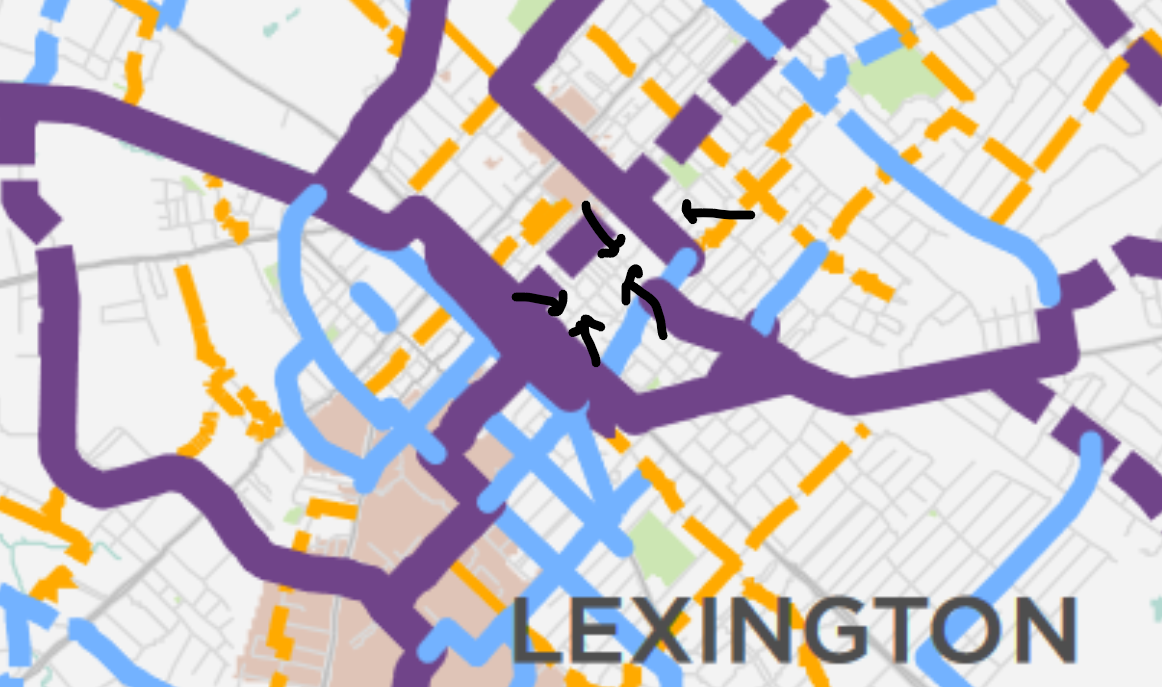
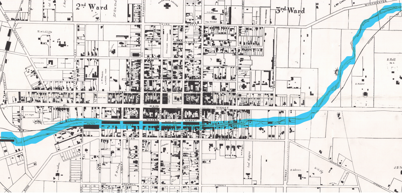
The above video covers the portion of MLK that I’ve marked below in black on the official Lexington Bikeways map.
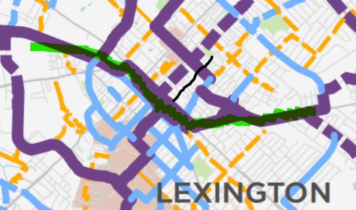
2018 Lexington Bikeways map with MLK portion from above video marked in black. Town Branch highlighted in green.
A third failure of the Limestone road project is that it has acted, like most exert-endorsed urban projects in Lexington, as a sort of compounding interest of elite failures. In declaring victory with the paint-on-a-road Limestone project, and then moving three years later to other burning civic priorities like the east-west running Town Branch Commons trail to Rupp Arena, the city abandoned further consideration of routes that better connected the university (the Gown) to its near-northside neighborhoods (the Town).
How significant was this mission-accomplished abandonment? By 2013, professionals across the city endorsed a Town Branch Commons plan submitted by Brooklyn landscape architect Kate Orff. The Orff plan called for the demolition of the MLK viaduct, along with the demolition of a second north-south viaduct that crossed at Jefferson Street. In order to create a better “viewshed” of Rupp Arena, Orff was prepared to demolish about 1/3 of the city’s north-south pathways into and out of downtown.
Our expert area leaders responded in concert, praising Orff’s idea as “the most authentic to Lexington,” “clearly implementable,” and a key infrastructure upgrade for improving our city’s biking/hiking infrastructure, for improving our ability to move freely and safely throughout the city.
Martin Luther King to High Street by bike. Summer 2022.
New Jawn
Yes. This. MLK IS better. Going over Vine St is a huge plus. MLK is much less trafficky than Lime, it feels safer, and the southern terminus is on Ave of Champions, which has decent bike lanes. It also allows me to go south on Rose, then cut through by the UK library or by the Chem-Physics building. I can then pick up University Ave, cut through Shawneetown, Central Baptist Hospital, to Rosemont. The absolute most dangerous intersection, though, is Nicholasville Rd at Rosemont — three near-death experiences. But MLK is so very much better than Limestone.