

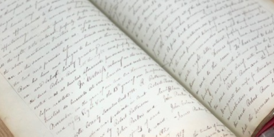
By Wesley Houp
To say a river is a living system is a scientific truism that even the most scientifically uninitiated intellect can grasp with minimal cognitive stretching: rivers teem with life, from unicellular diatoms to aquatic invertebrates and on up to vertebrata, fish, amphibian, avian, mammalian. Watersheds branch like trees, only their life-force moves in reverse from tiniest green-shoot to broad trunk, the faintest spring or rill gaining momentum, joining forces with other rivulets, debouching into larger creeks that eventually embolden the flow of master streams. Geologists, taking the long view of things, give rivers human-like agency, noting how they “capture” and “pirate” this or that watershed, or “desert” and “abandon” this or that channel, ever insisting on a course of least resistance. Rivers, like so much of life on earth, adapt to physiographic vagaries and persist through course of time as if accumulating the knowledge of experience.

Lock 3 is nearly topped by the Kentucky River, which ran at 16.5 feet on the Lockport gauge. Photo by Wes Houp.
But to say a river is alive, animated by a sort of conscious but unknowable will is not so easily grasped, particularly by those who have spent little time bankside or adrift on one. What is this consciousness but the pull of gravity, the swell of storm-water, and the turbulence of headwinds? What is it but cold, blind nudgings of fish barbels along some deep ledge? Perhaps the bioturbations of gastropods inching through fine-silted shallows and eddies, or the plashing of kingfishers and the winging acrobatics of thirsty bank swallows? Certainly it is these things. But certainly it is something else, particularly with a river as old as the Kentucky, whose origin reaches back to the far cusp of the Mesozoic world (perhaps even into Paleozoic time), whose waters were flowing a northwesterly course when giant reptiles held dominion, and later when large mammals, long of tooth, tusk, and trunk, grazed on grass of the rolling, featureless peneplains. The Kentucky, whose deeply entrenched meanders appeared to prehistoric nomads precisely as they appear to us today, is witness to hundreds of millions of years of earth’s evolution and, barring cosmic cataclysm, shall be witness to hundreds of millions more.
Now having paddled nearly the entire mainstream of the Kentucky, in all weathers, in every season, I can say with surety the river is a living system, governed by immutable geologic laws, and the river is alive—a singular entity that breaths and speaks a language all its own, perhaps the oldest tongue on earth—words we never knew for things long vanished, for things yet to come long after we, ourselves, have vanished. We catch the utterances in bits and pieces, like children overhearing hushed conversation between parents in the next room. And like children, the messages we construe are all preposterously self-serving. We hear conversation about ourselves; we want the river to echo our significance back to us. From the earliest record, humans have nominalized themselves as masters and victims of, along, beside, upon the river.
Morning of: tarps and shuttles
I would be remiss to suggest we operate like clockwork. I sleep until 8:30, the seven beers, three glasses of pinot, two shots of Zwack, and 13 replays of Curtis Mayfield’s Superfly soundtrack the night before a fine example of piss-poor decision-making. Danny is downstairs, hauling gear and dry bags up from the basement and amassing them on the living room carpet. “The rain stopped sometime early this morning,” he announces, dropping his tent and sleeping bag on the floor. “What do you think? Tent or tarp?”
“Tarp, definitely.” I reply. “What’s the updated forecast?”
“Cloudy, rain, sleet, snow, maybe patches of sun. Colder than we thought.”
Within an hour Keith arrives. We load boats and gear, say our goodbyes to Jules and babe, and make our way to Lyle’s on the south side of town. By 11:30 we’re on our way toward Elkhorn and the Kentucky, and by the time the caravan pulls into Stillwater Campground it’s already 1pm. A deeply rooted cluster of RVs backs up to the confluence. After unloading kit and caboodle on a mud-caked concrete ramp, Danny follows me back to Highway 127, and we turn north toward Owen County. The concrete bridge over Cedar Creek inhibits a clear view of the gorge below, and immediately to the west the small community of Monterey nestles down in perpendicular valleys where Cedar Creek debouches into the Kentucky. Even by car a cursory survey of the surrounding environs cuts a radical impression. With its white, clapboard houses and sleepy, redbrick downtown, Monterey sits in a Pleistocene “break through,” where, according to the late W. R. Jillson, former state geologist, Cedar Creek and the Kentucky had run in parallel “opposing out-bows” to the north, separated by a high, narrow ridge, evidence that both streams followed entrenched meanders. Once this dividing ridge was breached, Cedar Creek was significantly foreshortened; the lower stretch of its valley was deserted and left to accumulate new headwater capillaries and form a new drainage, known today as Pond Creek.
Lock 3 is nearly topped by the Kentucky River, which ran at 16.5 feet on the Lockport gauge. Photo by Wes Houp.
Route 355 breaks from 127 just north of Monterey, cuts to the northwest and quickly dips down into Cedar Creek’s deserted channel, broad valley cradling diminutive, derivative Pond Creek that rejoins the Kentucky with significantly less fanfare four or five miles downstream. From here, 355 skirts the mainstream, a narrow pass hugging crumbly cliffs, identified on the barge maps as “Sliding Bank,” to the iron bridge at the mouth of Severn Creek. The river then bends to the southwest on the downstream side of Clements Bottom, and 355 continues northwest toward the community of Gratz. Across Route 22 bridge, Lockport and lock 2 are just a short drive down Route 389. We leave my truck at the public ramp in Lockport; lock 2 is submerged, the upper gates barely visible in the swirling water, and we slow to a ponderous 5 mph, sizing up the current, the highest and swiftest we’ve yet dared to paddle.
Elkhorn to Webbs Bend
We make the shuttle in a cool 45 minutes. Back at Stillwater, Keith and Lyle have befriended the natives. “Dennis” of Monetery, now a permanent resident of the campground, is issuing a clear but friendly warning: “Better keep your matches dry ‘cause your asses are gettin’ wet.” At 2:30 we push off, the Elkhorn’s swollen current catching each craft, and just ahead, the Kentucky, irritated by last night’s torrent and today’s headwind, pushes impatiently around Elkhorn Bar.
At the confluence, the river cuts sharply southwest then, in less than a half-mile, sharply back to the northwest. Elkhorn Bend forms an acute, northerly-oriented “hook,” around which the Kentucky constricts and picks up the emboldening tributary waters. Immediately out of the mouth, though, we encounter a tremendous eddy, momentum of the Elkhorn’s current pushing us southeast, and then the reverse flow of the eddy spinning our canoes northeast at the point of the “hook.” We circle in the converging forces, and Danny, rummaging in a dry bag, produces two Sunrise Bakery sandwiches—hard salami, Asiago, oregano pesto, on baguette—calls for us to raft, and halves them between the four of us, our momentary savior performing his routine miracle of meat and loaves and we the acquiescing disciples making orthodoxy of his riverine, epicurean sacrament. With sandwiches in one hand and paddles in the other, we nudge into the channel, spinning, eating, fully given over to disorganized whims of rising water.
Immediately around Lower Elkhorn Bend, the river resumes a northwesterly course and low rock bluffs blot out the sun in the southwest. The current has carried us several miles in little more than 20 minutes. “The community of Polsgrove is somewhere up ahead, squarely in the fluvial lap of a deserted meander.” I consult the navigational chart while Lyle surveys the bottom.
Keith scans the bank. “I see a few dilapidated tobacco barns, but that’s about it.” The winter sun has long since cracked its apex by the time we reach the mouth of Flat Creek. Just ahead the river cuts 90° to the east around Payton Bend, and in less than a half-mile more we enter Webbs Bend.
Camp on the mainstem
“We should bivouac along the eastern shore.” Webbs Bend presents broad bottomland, named LeCompte Bottom on the topographic map, but the sight, sound, and smell of cattle, as always, push us farther along. The eastern bank is narrow with no real options for camping except for infrequent, natural benches dotting the foot of a sharp, wooded slope. Lyle spots a dry, rocky cut, winged by two such benches, jabs a paddle down, and turns to investigate. The troupe follows suit. The afternoon is dark gray, the current erratic and murky. The near-vertical gulch stretches up 250 feet between large limestone outcroppings, and the upstream bench, perched 30 feet or so above the river, is large and clear enough for camp. Mature sugar maples secure the perimeter.
After we pack up the gear, Danny clears a large circle in the leaves. “We need fire.” He forages wood along the steep incline behind us while Lyle and I unfurl the large tarp, strapping each corner to the nearest sugar maple. Keith finds two adequately spaced maples and hangs his hammock. The wind dies a little, the temperature hovering in the mid-thirties. We haven’t seen the sun all day. In twenty minutes, Danny has conjured a fire from damp sticks, and by dusk the flames dance head-high. For dinner, Lyle has prepared a stew, large cuts of grass-fed beef marinated with onions and garlic in some sort of brown, gingery sauce, to be wed with a freezer bag full of broccoli, zucchini, peppers, carrots, and cabbage. For starters, though, he greases the pan with homemade Andouille sausage. The aroma wafts up through the canopy and weathered limestone bluffs. Silence and growing darkness lean in for a closer whiff. A pack of coyotes yips a distant approval from the far side of LeCompte Bottom. Thin cloud-cover hollows out the moon, refracting just enough light to spark animal eyes, show old ghosts how to find us should we fall asleep unaware.
LeCompte Bottom to Monterey
Per usual, Lyle’s up early the next morning. “The sleet stopped about an hour ago. Coffee’s just about ready.” For breakfast, we reheat last night’s stew, adding water and a cup of fresh-ground grits. It’s a strange but tasty concoction, a sort of hearty breakfast paste, just what a body needs to fortify itself against the 20° weather. The river has a way of turning everything brown, particularly the food. Here, the cumulative result of all colors is a muddy brown, an ancient addendum to color theory. We linger around camp for several hours, sipping coffee, lapping up hot brown mush, unwilling to relinquish the small patch of comfort we’ve imposed on a remote stretch of river-bend. The wind rips upstream, scours our perch. The water is nervous with whitecaps, and in the short lapses between gusts, long rolling swells shudder down the channel. We marvel at the unsettled surface, and sit in hushed recognition of such dangerous potential.
A shaft of sunlight summons Keith from deep trance. “Time to go, boys.” He’s first in, and the rolling tide catches his stern, sucking him from the sycamore bank and licking his gunwhales. He maintains stoic composure, paddle-thrashings measured against 80,000 cubic feet per second, and in a minute he’s gained enough advantage to find the eddy above our little landing, adeptly reorient, and release into the current on terms more suited to his liking. He jets past us, this time finding a narrow eddy downstream and banking to a slender hold. We watch him with a mixture of amusement and dread.
I’m next in, trimmed but awkwardly poised. Failing to reach the upstream eddy, I let the current reorient my canoe, thankfully weighted to bow, and as the waves begin to top my gunwhales, I’m facing downstream. With several quick J-strokes, I find a slender hold below Keith’s position. Danny and Lyle cast off without catastrophe. In tight formation, we set off, the headwind roaring cold static with a backbeat of lapping waves. Two miles later, we bend to the north, and the distant roar of water over the spillway, still two miles ahead, helps focus our attention on more existential endeavors.
Final approach and portage: Lock 3
We pass Balls Branch to the east and Stevens Branch to the west, and the crushing rapid over the spillway throws white spasms of water high in the January air. We make the Henry County side, and Lyle lands to scout portage, the rest of us holding bank, uncertain of his report. But in ten minutes he returns with skip and smile. The water level is only a foot or so below the top of the lock wall, and if we hug the bank, we can ease up along the inner wall and withdraw above the upper gate. So we proceed with care, maintaining course just outside the flooded, overarching trees. Inside a half-hour we stand on the lock wall like shipwreck survivors, boats and gear splayed around us on the cut-limestone apron.
Construction of Lock 3 began in 1836; it was put into operation in 1840 and modernized in 1882. In 1843, lockmasters were appointed, paid an annual salary of $250, and provided housing adjacent to the locks to comfort them in their duties. After the Army Corps of Engineers assumed responsibility for overseeing Kentucky River navigation, they constructed additional houses at locks 1-5 in the 1890s. At lock 3, where both houses still stand, the Corps-built dwelling is far more ornate than its state-built predecessor. The “newer” house sits directly above the lock and displays the flourishes of design and appointment indicative of the Victorian period. Sadly, like so much Kentucky River infrastructure, both houses languish.
“Better shove off.” Danny slaps his hands together and laughs. “The longer we’re on land the less time we have to get ourselves cold and wet. And I’m in it for the cold and wet.” Lyle gives him a wink. “You’re in it because you’re a compulsive river-whore, like the rest of us.” The clouds have given way to the kind of blue that almost gives away the universe but leaves the wonderer staring too long, straining neck and shoulders. All this water, all the water of the earth, finding the right stratigraphy to step down and down, increasing in volume, its hoarse whisper “here I come again” reverberating from the comet-wind of Archean time, and we standby, our lives a quivering drop of water. We grouse about weather, politics, religion, what humankind will do to itself and the earth, while the river goes on unconcerned with reckless machinations of the brainy species. The river will have us in the end, call our water back to its flow as a habit of course. In the words of naturalist Loren Eiseley, “As for men, those myriad little detached ponds with their own swarming corpuscular life, what were they but a way that water has of going about beyond the reach of rivers?” We gather by the boats, pass the bottle of Beam, and reenter the wind-tussled current hell-bent on making good time to Severn Creek, our projected second-night’s bivouac, as if our time—our quivering drop—is all there is.
Leave a Reply