

Wes Houp, “Up on Chenoca”
When development came to the bluegrass, it came from the east. From Fort Pitt at the confluence of the Monongahela and Allegheny Rivers on past the Kanawha, speculators from James Harrod to Johnny Appleseed floated the Ohio in search of available productive land. Harrod, like many of the early illegals who explored the region as citizens of invading British and American nations, came into the bluegrass by turning left at the mouth of the Kentucky and paddling, upriver, as far as Leestown. Later, by the 1780s, new arrivals to central Kentucky would shorten this trip immeasurably, by disembarking at the settlement of Limestone and then taking the southern road toward the growing frontier town of Lexington.
Further south in western Virginia and North Carolina, river valleys like the Doe, the Watauga, and the Holstein, the Clinch and the Powell, provided staging grounds for a different eastern invasion. Speculators and hunters like Dan’l Boone used overland outposts at Long Island and Martin’s Station to hop across the Appalachian Mountains, one river valley at a time. Boone, a farmer from North Carolina’s Yadkin Valley, built the first white-man highway system in the state, hacking the Wilderness Road in 1775 from the Cumberland Gap straight through to his home settlement at Boonesborough on the southern banks of the Kentucky River.

Leaving Boone Creek, March 2010
Fayette County, originally an appellation designating land that stretched from the northern banks of the Kentucky River north to the Ohio River, was the chief recipient of this early American development fever. In the intervening centuries, Fayette’s given up most of its Kentucky River shoreline, though it still forms the county’s southernmost border and houses some of the oldest gringo history in the state.
Murderously stupid
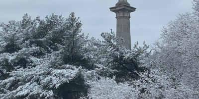
Boone Creek, which marks the boundary between Fayette and Clarke Counties, has recently been in the news. A Boone Creek landowner is attempting, thus far unsuccessfully, to create a zip-line adventure site throughout his creek-front property. We didn’t know it at the time, but some years back several of us Slackwater Paddleventurists spent a cold early-March night squatting on some fine Boone Creek bottom-land that, as it happened, faced the controversial Boone Creek tract.
Years earlier, before we were slackwater, after a torrential downpour a couple of us ran Boone Creek out of Athens, floating past the hunt club located on its banks and into the Kentucky River. This is not suggested, certainly not in a 17 foot Coleman Canoe with only 2 beers and a battie to count as provisions, but it was fun nonetheless.
The accompanying song, “Up on Chenoca,” is another by Wes. Chenoca was an early name for the Kentucky River, back in the days when Pennsylvania and Virginia and Carolina yahoos were swarming into town and these things, names, were still being decided.
Mongrel hordes
Camping on the Kentucky River and its tributaries remains a pioneering act. One is always engaged in the act of tresspassing on someone else’s land. This account is of the one time our camping plans were foiled by vigilant landowners defending their private property. In hindsight, it is not surprising that this singular repulsion occured on Fayette County land.
Providing additional speaking roles, in order of appearance, are John Lackey, Warren Byrom, Jeff Gross, Beth Connors Manke and Wes Houp (roughly 1/3 of the people in attendance). Warren provides additional accompinement with a rendering of Marty Robbins’ “Bend in the river.”
Tates Creek Taters
Ever wondered how Tates Creek got its name? Wes takes us down the colonial memory hole. His river narrative is accompanied by the first known recording of Chris Sullivan’s ever-changing opus, “Fayette County.” Ask him to play it when you see him performing about town.
Made you look!
It’s easy to think of the Kentucky as a ribbon of slackwater cutting through the eastern and central part of the state. But the Kentucky is much larger. Fed by hundreds of watersheds, it is less ribbon and more basin, a convergence of a large swath of capillaries covering an area of 18,500 Commonwealth square miles. In Fayette County, part of this great basin, our water drains from nine different mini-watersheds, all twisting and dropping their way eventually into the Kentucky.
To get a sense of where everything ends up, imagine driving in a rainstorm on Liberty Road. At the mouth of Liberty on Winchester Road, Charlie’s Seafood, the water under your tire drains west into the Town Branch watershed flowing through town, and it into the Elkhorn, and it, finally, just past Frankfort into the Kentucky River. Travel a half mile from Charlie’s, just past the Lunch Box at Henry Clay, and the water spit off by your wipers drains into the West Hickman watershed, south through Veterans Park and into the main fork of the Hickman and its Kentucky confluence at Camp Nelson where Nicholasville Road crosses the river–a full 95 miles upriver from Charlie’s Town Branch watershed.

Blake Eames and Claudia Michler hard at work. Photo by Brian Connors Manke.
Get past the stoplight at New Circle, and you’ve entered the North Elkhorn watershed, meaning–you guessed it–the Chick Fil A lemonade you just dumped will no longer dribble south to Camp Nelson, but rather north and then west, reuniting outside Frankfort at the forks of Elkhorn with the rest of your Town Branch tire-water. Hold steady on Liberty and continue toward Man O’ War, and the exhaust pooling into little chemical puddles underneath will re-route again, into the East Hickman watershed, toward an eventual reunion at Camp Nelson with your your West Hickman wiper-water of 7 minutes earlier. Cross Man O’War onto Todd’s Road, and Boone’s got you, or at least his creek’s watershed does. The rain here, seeping into less-paved rural lots, will collect into dry runs and move downhill for the county line nearby the I-75 overpass and Bull Hell.
Beth’s piece here covers an art project taken on by Claudia Michler and Blake Eames that called attention to some of these watersheds. The two artists spent much of a summer and fall painting downtown and near-downtown storm sewers to highlight the need for clean and efficient systems. Art that makes people look down, not up, that makes us ponder our immediate world underfoot? That’s NoC‘s type of art!
Chris closes with a reprise of “Fayette County.”
Leave a Reply